UNL Engineer Says Agriculture Could Lead in “Drone” Usage
By Steve Ress
Drones are seemingly everywhere. They fire our imagination and spark our love of technology. Lots of people seem to want one, but few of us know much about them or what they can and cannot do.
In a relatively unexplored but nonetheless expanding commercial market for unmanned aircraft systems, or UAS’s….drones to most of us, research indicates that agriculture could eventually account for 70 percent of their business use, according to University of Nebraska-Lincoln agricultural engineer Wayne Woldt .
“Their use in expanding precision agriculture, managing agricultural systems and gathering critical data needed by producers could be limitless and is just now being explored,” the longtime UNL Department of Biological Systems Engineering and School of Natural Resources water resources engineer said.
Woldt has always been interested in finding answers to seemingly complex engineering challenges and drones, or UASs, seem to be one answer in getting oncoming technology into the hands of the researchers and producers that can make the most of it.
Trouble is, at this time, not just anyone can go fly a drone as a part of their business enterprise.
“Except for some very limited uses and altitudes for what most people call recreational or hobby UASs, the FAA (Federal Aviation Administration) says you have to have a private pilot’s license to operate unmanned aircraft for any commercial purpose, including agriculture,” Woldt, who’s been a licensed private pilot for years, said.
“It is highly likely that those regulations will change in the near future, with projected release of new unmanned aircraft regulations for commercial flight in June of 2016. It is expected that the new regulations will require an Unmanned Aircraft Operators Certificate that can be obtained by passing an exam administered by the FAA. The rules are constantly being examined and reevaluated, but for now a (pilot’s) license is required for commercial UAS flight” he said.
Working with students and fellow private pilots, including a retired Nebraska Air National Guard fighter pilot, Woldt has assembled a small but dedicated cadre at UNL that are currently using two drones to expand the borders of what is known on how UASs can be used to help agriculture and natural resources, with an initial focus on water management. In addition, Woldt seeks to collaborate with other University of Nebraska faculty to advance a wide array of unmanned aircraft research opportunities.
“There is an immediate need to form a critical mass, and nexus of UAS-based research and development at UNL, to explore and solve fundamental science and engineering challenges of UAS for agricultural and natural resources use, as new regulations are developed. Other universities are working on this as well, but we’re “holding our own” in terms of agricultural applications,” Woldt said.
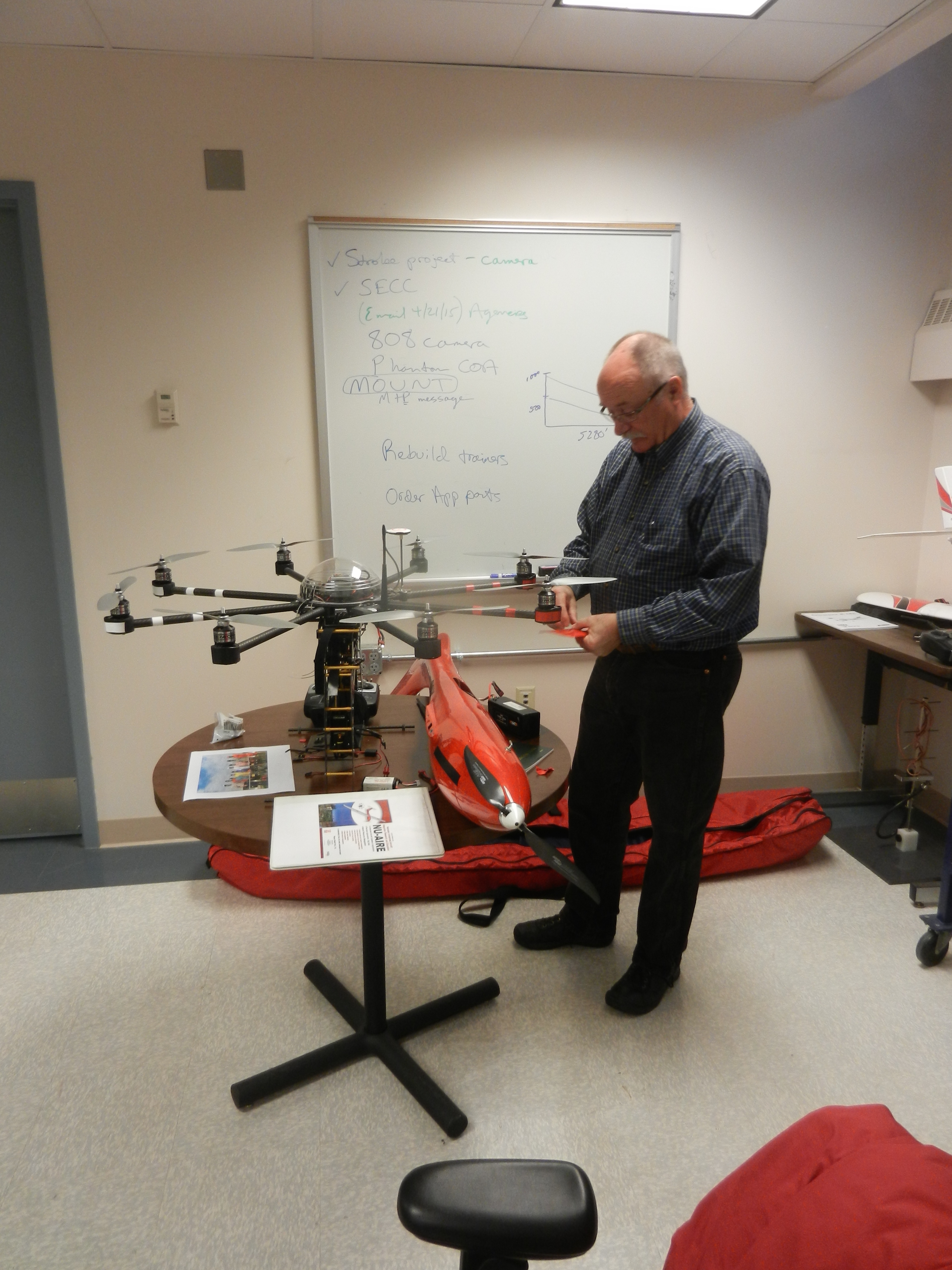
He and his small but dedicated group fly both a large, fixed wing UAS that resembles a scale glider with a wingspan of 11 feet and an electric motor for extended flight duration of almost two hours, and an eight-motored “octocopter” that would not look out of place in a Star Wars movie.
Both are used to test fly equipment and sensors, many of which are developed and or adapted locally in Woldt’s “Nebraska Unmamed Aircraft Innovation, Research and Education (or NU-AIRE) laboratory on UNL’s East Campus.
“Through NU-AIRE we are providing the leadership to develop research and education efforts around many UAS development needs for their practical use in agriculture and management of water and natural resources,” Woldt said. These include, but are not limited to:
- Crop and optical sensors for agricultural applications (precision agriculture)
- Sensor technologies for natural resource management (hydrologic observatories)
- Contributions to agricultural resilience under climate variability (enhanced real time data for dynamic management)
- Crop scouting, ranch and livestock management opportunities (cattle tagging and tracking)
- Water management applications for flood assessment and irrigation management
- Soil moisture and vegetation type/index (stage of growth of crop)
- Remote sensing platform with multi-spectral sensors
- Standards and performance verification in support of agricultural industry
- Policy, law, and regulation development and analysis (air space use, privacy)
- Management and application of pesticides (crop dusting)
- River tracking, riparian status, and water area coverage (changes in rivers, ecosystems, ponds)
- Communications and data transfer systems protocols and standards (wireless/cell phone)
“We are just beginning to seriously explore what UASs can do for agricultural and natural resources management. As a vehicle for those purposes, the technology is just in its infancy. The UAS market could double in the next few years with potentially explosive growth in the next decade, coupled with advances in the aircraft and sensors themselves, so this is clearly an area we need to invest time and research efforts into.
“For the sake of the state’ agriculture industry and natural resources management, we need to stay ahead of this new technology. It offers an unparalleled opportunity to place sensors, robotics and advanced information systems at desired locations on a near real-time basis, for improved efficiency of agricultural operations,” Woldt said.